
What did St Johnston Look Like Years Ago?
St Johnston or the town of St John, a nickname for St Baithin, used to be a borough. The town used to return two members to the Irish Parliament. It had a court. One recorder presided over the court.
1618
In 1618, the town was a small village or clachan. The houses were humble thatched roofed dwellings in a group inhabited by people who came over from Scotland in the Plantation so that they could defend themselves better against the Irish who had a lot of resentment towards them. The town was so small in 1618, that plans were made to bring in thirteen Englishmen or Scotsmen to build houses in the area – to build a new town in effect. This reflects the poor state of the existing town. It was complained that the existing town just didn’t stand a chance against attacks from the native Irish. The plans didn’t come to fulfilment.
At the time, thirteen families from Scotland were housed in a single street. The town consisted of one street back then.
The Bridge
The Bridge that presently crosses from St Johnston to Ard Baithin is an important help to working out how the town was planned in days long gone.
The Bridge was mentioned on 13th March 1752 in the Abercorn Papers. Therein it was stated that there was an acre of land one acre in size near the bridge that belonged to nobody in particular. This land was on the St Johnston side of the bridge because the other side was stated to be a “large park in Dundee…held by McLairn the miller of St. Johnston”. Later that year, 24th April, it was stated that the tenants were making their gardens from the acre. The tenants say that they were given the land in return for green linen they provided.
There would have been only a lane or dirt track down to the sore for the fishermen from the town.
The original town would have been located along the current Main Street.
The current bridge to Classygowan didn’t exist until after 21st July 1783 where the budget they hoped to stick to was £15. The description is a bit odd, “The bridge between Clashygowan and St Johnston mill”. But nevertheless what was meant was the bridge between St Johnston and the Mill at Clashygowan. The road accords the bridge would naturally have been created at the same time as the bridge. That the road was created does not suggest that there was no house located where the current road meets the Main Street. There could have been a house that was demolished for the purpose of making a road.
16th January 1789
We know Church Lane existed then because on 18th April 1787 it was recorded that there was room for four or five houses facing the Church Lane despite there being four small houses already.
Why is Church Lane described and not the Main Street apart from the mansion house? The answer would seem to be that Church Lane only came into existence recently.
In 1789, the buildings in the town of St Johnston on this date were described as “building tenements ,some not finished, others they have let run into ruin, the roofs supported by props. John Galbraith a blacksmith is one of these. He owes a great arrear and has nothing.”
A Widow Davis was living in her tenement tough most of the roof had fallen in.
Adam McKay’s tenement fell down completely and plans were made for a James Smyth to rebuild it.
Taylor and Skinner's Maps of the Roads of Ireland of 1777 has St Johnston on it.
The McCrea and Knox Map of 1813 was concerned with cataloguing poverty and road building schemes and structures. There was a ferry on the Foyle that crossed to Carrigans and St Johnston and the St Johnston townland of Carrickmore.
The Mansion House Today
We read in the Abercorn Papers from 1789 that facing the Main Street there was a mansion house. There is a candidate for being the mansion house. Mansion houses survive longer than ordinary dwellings. Mansion houses naturally have stables.
This is how the mansion house currently looks.
Here are photographs of the stables.
The mansion house had a doorway blocked up with stones that was visible until 2002. The doorway was obviously the main door of the house.
Ordnance Survey
The 1836 Ordnance Survey stated that there were five flax mills, a flour mill and a corn mill in Carrigans. They were ineffective at getting people in the area out of starvation and unemployment. The machinery lay idle most of the time. The cottages were described as very dirty and far too small by Mr Scott who was a farmer from Mullennan near Carrigans.
1870s
The local Temperance Society built a Temperance Hall in St Johnston in the 1870s at Church Lane. Later members of the Society and founders of the Society decided to form a Congregational Church in St Johnston. The main purpose of this was that members believed that grape juice, unfermented wine, should be used for communion for scripture in their opinion absolutely forbade alcoholic drink. This belief meant they had to leave the Presbyterian Church and the Established Church because of their use of wine in communion and their approval for taking alcoholic drink though not to excess. The need for a Temperance Society reflected the mood of the time that addiction to alcohol was a huge problem in the country in general and suggests that the St Johnston and Carrigans area was no exception. The horrors of poteen played a huge part in the stigma the Society felt towards drinking.
There was a mill at Milltown, St Johnston.
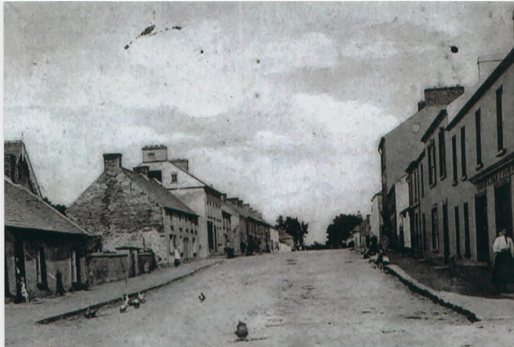
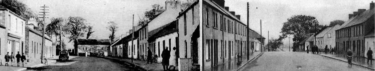
1900
The Main Street looked as much as it does today.
There was a house, part of it was demolished and part was retained that Sammy King lived in. The existing part became Humphrey Dunne’s Electrical Store. He built a workshop out the back to fix electrical appliances. There was a shop at the front selling electrical equipment and batteries and so on. It is now M1’s hair salon.
Opposite the road was a house in which people lived and the house passed into the ownership of Joe Gibson who had the house demolished in the 1970’s.